Visit of World Bank representatives to FGA - Consultations on a new project
On March 26 and 27, 2024, representatives of the World Bank visited the Federal Administration for Geodetic and Property-Legal Affairs for final consultations regarding the approval of financing for a new project in the Federation of Bosnia and Herzegovina. The World Bank delegation included Mr. Christoph Puscha, Practice Manager, Mr. Paul Scott Prettitore, a land administration specialist, and Ms. Samra Bajramović, Operations Analyst in the World Bank office in BiH. The new project, named GIVE (Geospatial Infrastructure and Valuation Enhancement Project), is planned to start in 2025 and aims to provide support in harmonizing real estate data between the Land Registry and Cadastre, public disclosure of cadastral survey data, development of spatial data infrastructure for FBiH, mass property valuation, and building registration. The FGU delegation was led by Director Željko Obradović at this meeting, and discussions were held in a constructive atmosphere with an exchange of opinions and ideas about the implementation of this important project.
Workshop „Metadata management and technical guidelines“ held
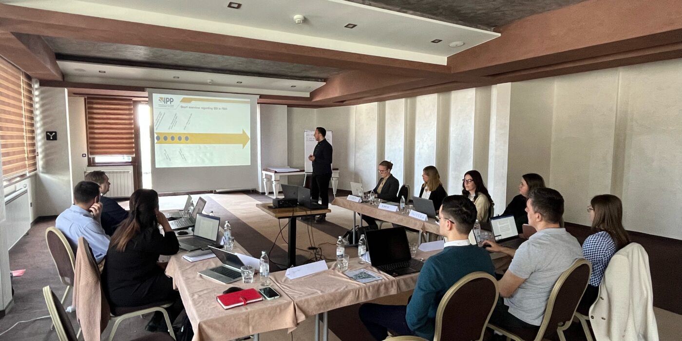
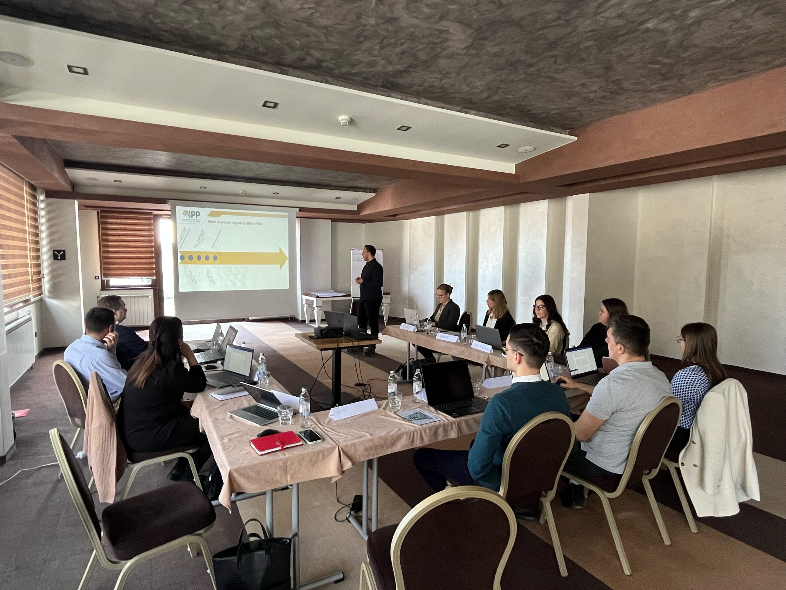
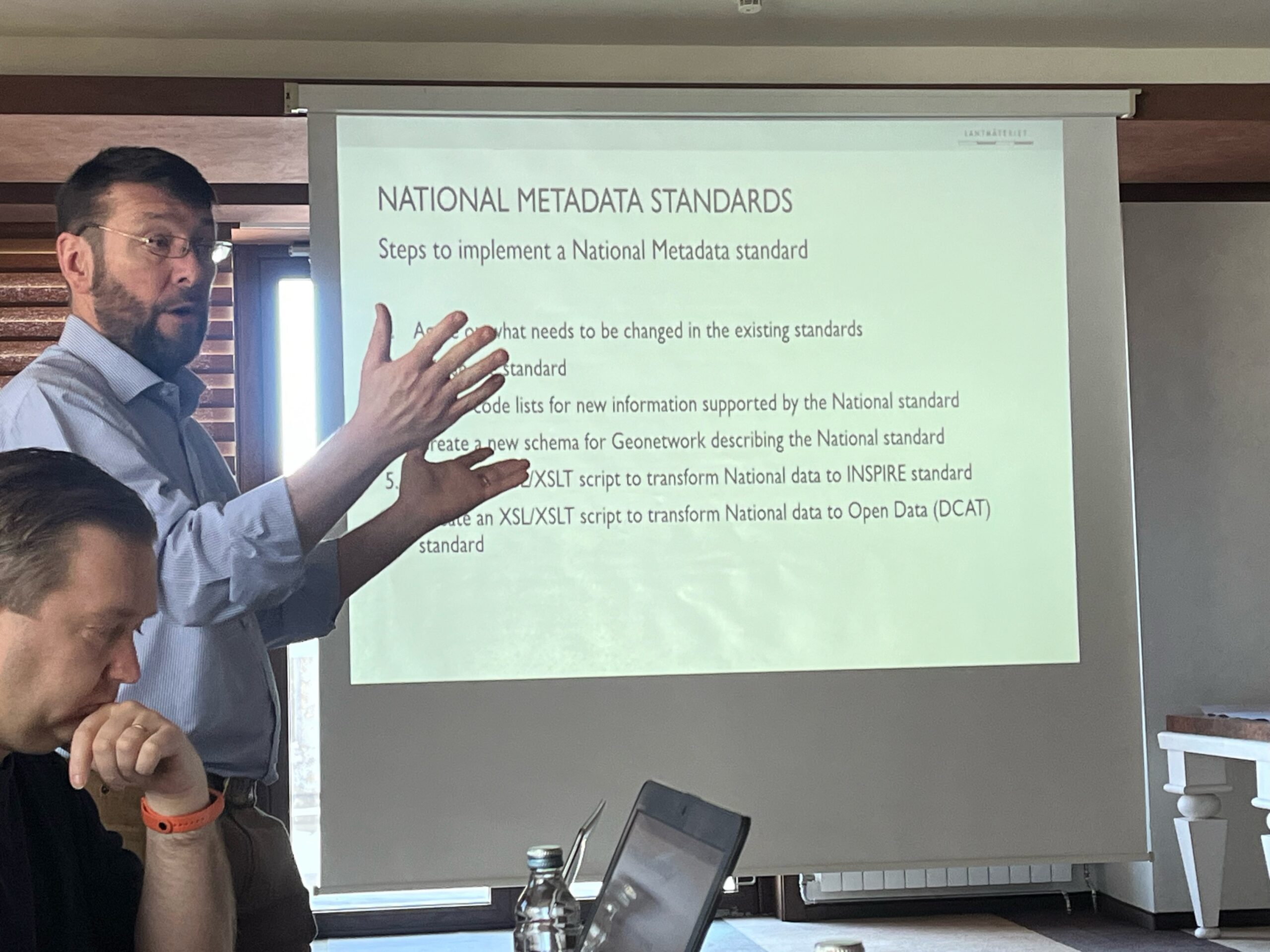
In accordance with the planned activities within the Swedish DELEF project, a workshop was held in Jahorina in the period from March 19 to 21, 2024 within the framework of component 3: Spatial Data Infrastructure (SDI).
The workshop was led by Swedish respective experts on behalf of Lantmateriet, Mr. Peter Bodley and Mr. Henrik Söderkrantz.
During the workshop, the working groups presented the implemented activities in the field of Spatial Data Infrastructure to the experts. The main topics of the workshop were Metadata Standards, a Metadata Catalog in which the Swedish national metadata profile was presented, as well as legal regulations and INSPIRE, after which detailed technical specifics were discussed.
The aim of the workshop was to present an example from Sweden, and in connection with the steps in the implementation of the SDI in the FBiH in accordance with the INSPIRE directive and implementing rules, to give the working groups guidelines for planning the next steps and activities.
Information regarding the new visual identity of SDI FBiH
Dear All,
We would like to share the information that for the needs of the Spatial Data Infrastructure of the Federation of Bosnia and Herzegovina, through the engagement of the SDI FBiH Authority and Coordination Body, an important activity of identification, creation and adoption of visual identity was realized.
The Year 2023 was, among other things, marked by intensive work on improved possibilities of presence and recognition of IPP FBiH among the professional community, users and the public. As the Coordinating body of SDI FBiH, the Federal Administration for Geodetic and Real Property Affairs (FGA) took a leading role in this process to ensure that the visual identity of IPP FBiH reflects the identified values and goals of SDI FBIH.
We are pleased to highlight that the SDI FBiH Council formally adopted all elements of the new visual identity and supported the use of the same for all aspects of communication related to the SDI FBiH and the activities being carried out.
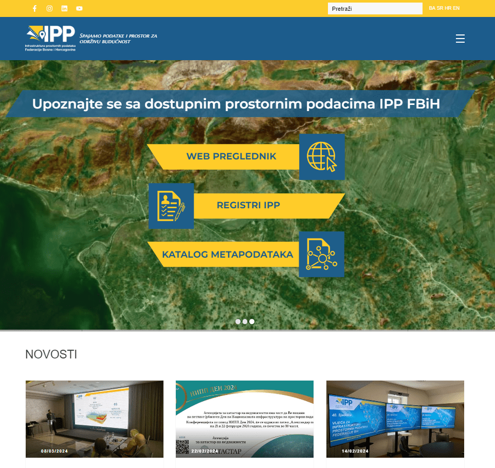
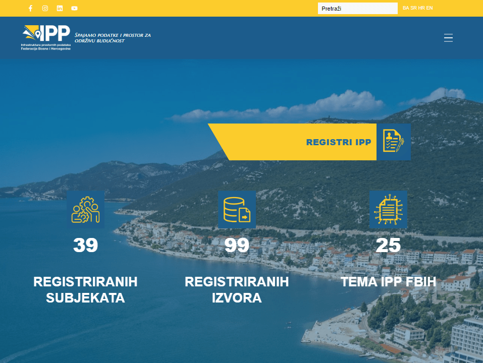
One of the most significant changes is the redesign of the official website of SDI FBiH, https://ippfbih.gov.ba/, which now provides an improved user experience and facilitates access to information regarding SDI FBiH and related activities.
The new logo and slogan “We connect data and space for sustainable future” clearly reflect the mission of connecting spatial data with the aim of supporting a sustainable future for all citizens of the Federation of Bosnia and Herzegovina.
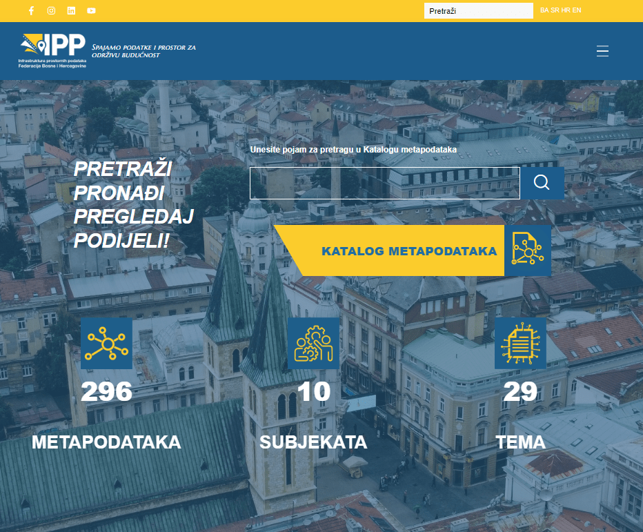
In addition, we have continuously worked to improve the visual presentation of our applications, including FBiH SDI Registries, FBiH Metadata Catalog and Web viewer, to ensure that our users have easier access to key information and tools. The same can be accessed from the official website of IPP FBiH.
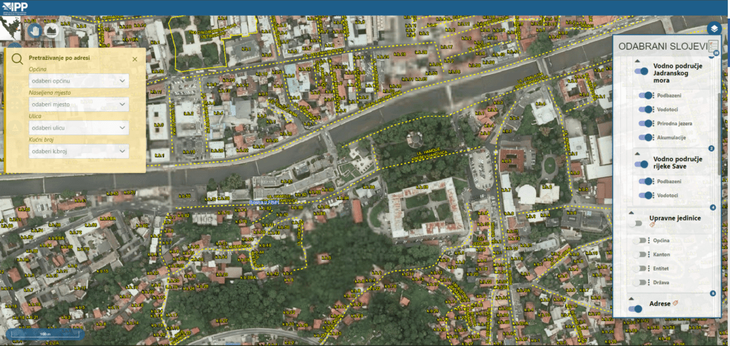
The new Viewer of the SDI FBiH has been improved and put into use. The Viewer is Web GIS application that displays spatial data based on previously established web services of standardized spatial data held by SDI stakeholders. The primary goal of establishing the Viewer of the Spatial Data Infrastructure FBiH is to ensure easier access and use of standardized spatial data held by SDI stakeholders.
Furthermore, in order to provide a greater number of communication channels for different types of content and media, we created profiles on the most popular social networks LinkedIn, Facebook, Instagram, YouTube. Through these platforms, in the future we will regularly inform you about news, events and materials of importance for the work of the SDI FBiH and related bodies.
We invite you to explore our new visual identity, visit our website and follow us on social networks to stay informed about the latest developments and initiatives we are implementing.
With respect, Federal Administration for Geodetic and Real Property Affairs, Coordinating body of the Spatial Data Infrastructure of the Federation of Bosnia and Herzegovina
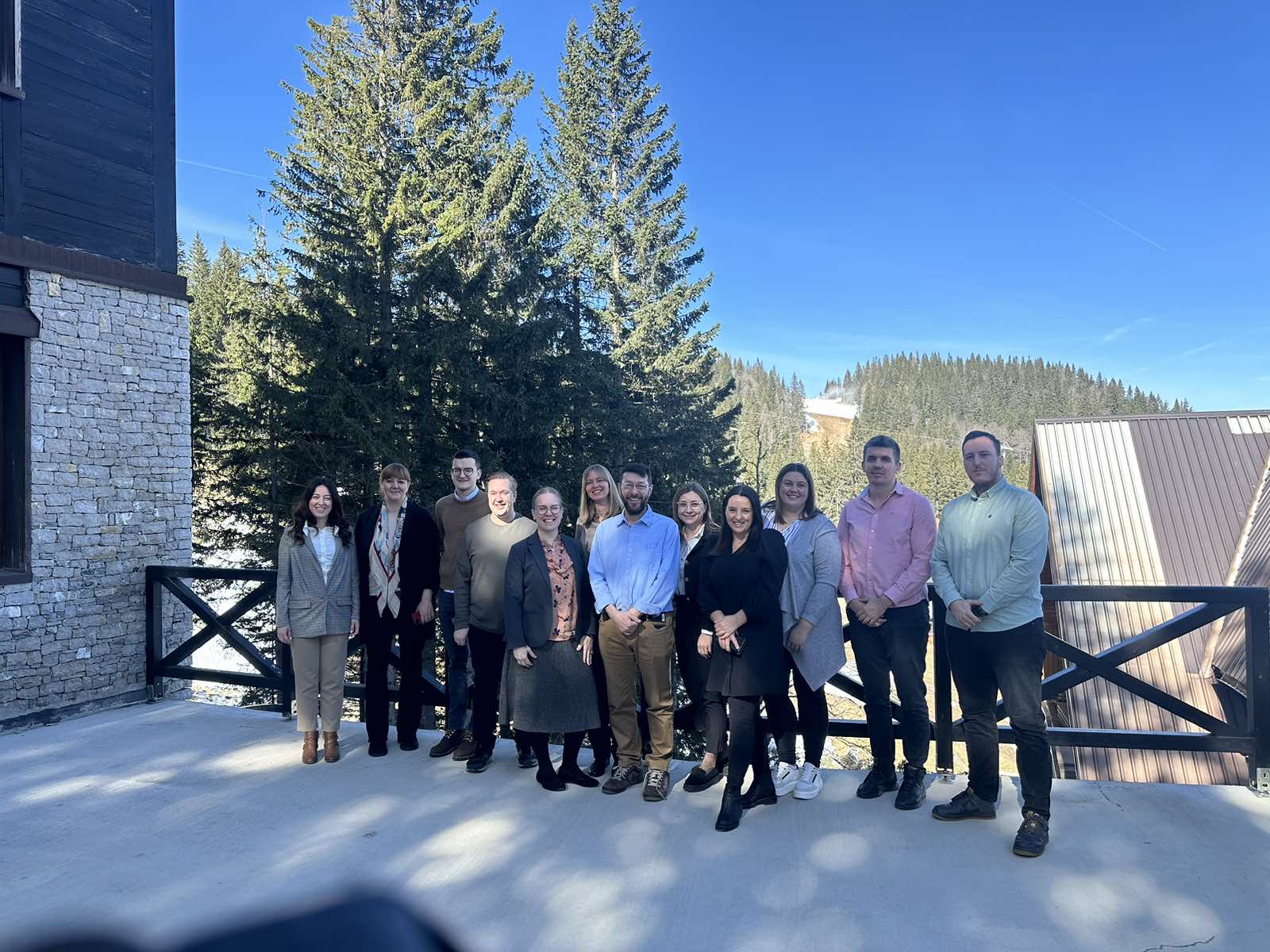
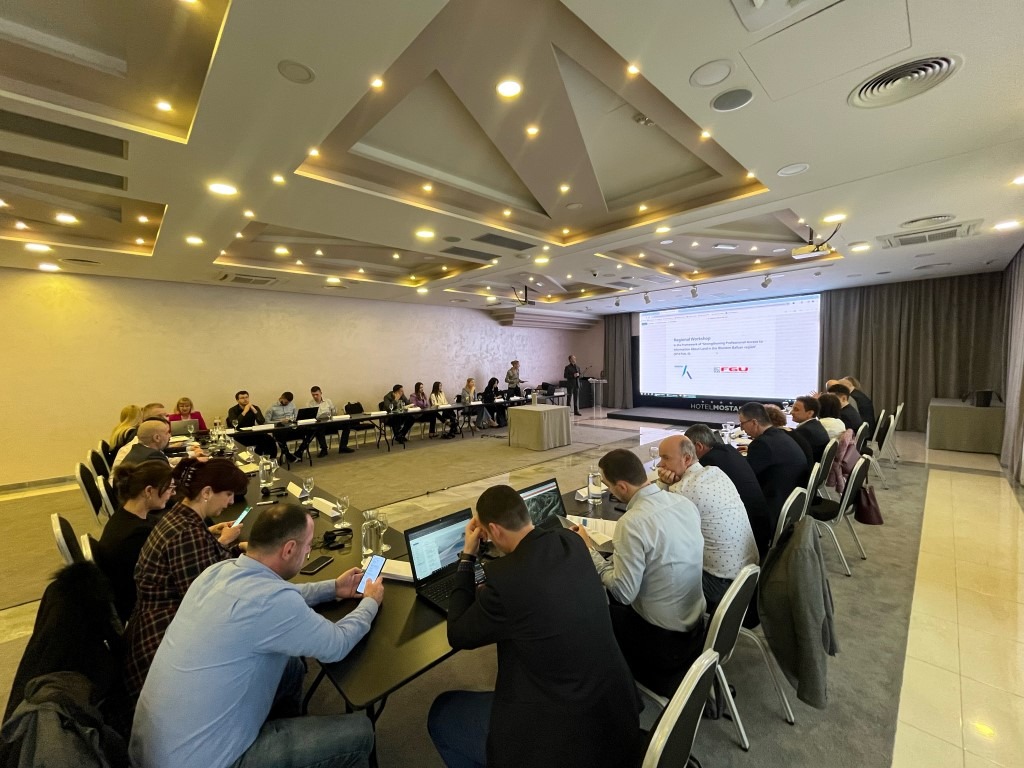
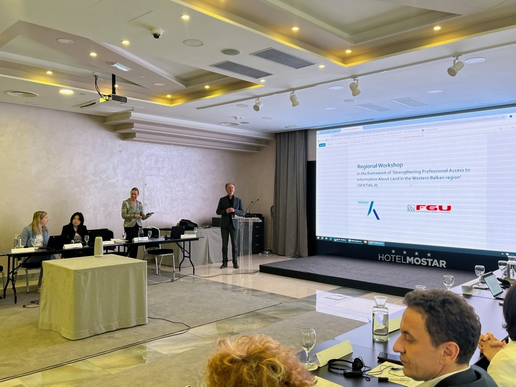
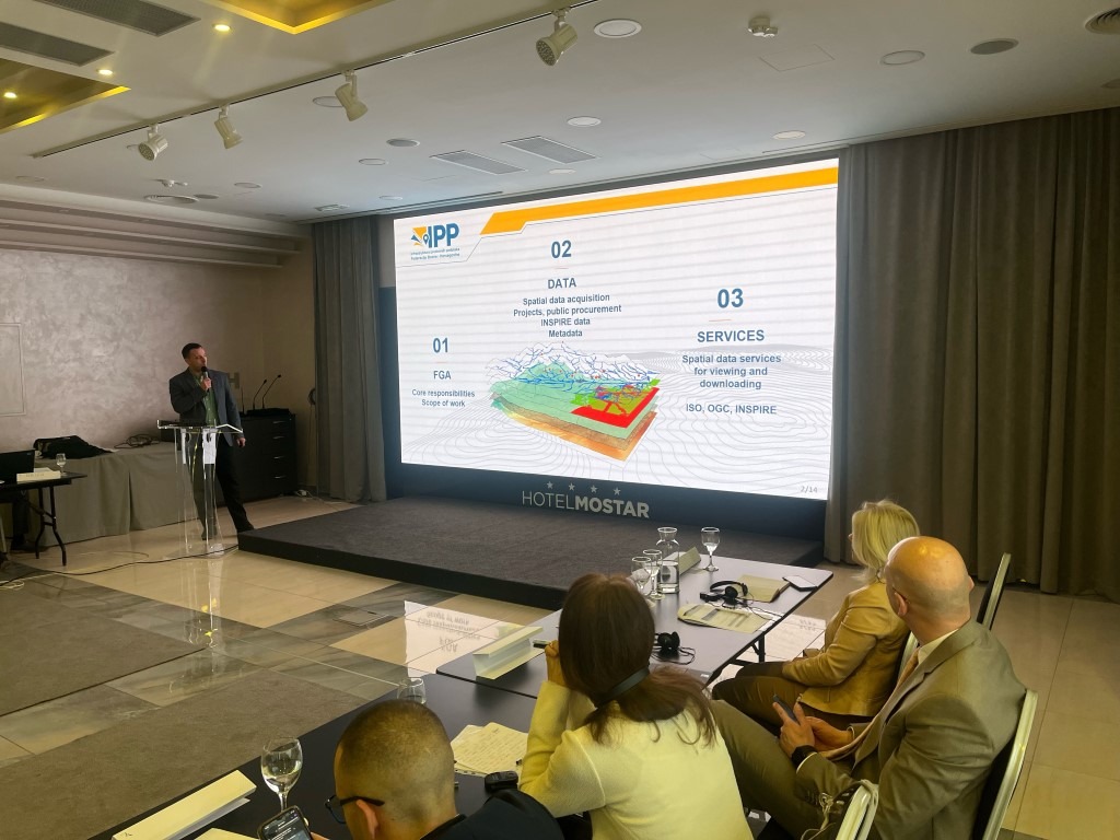
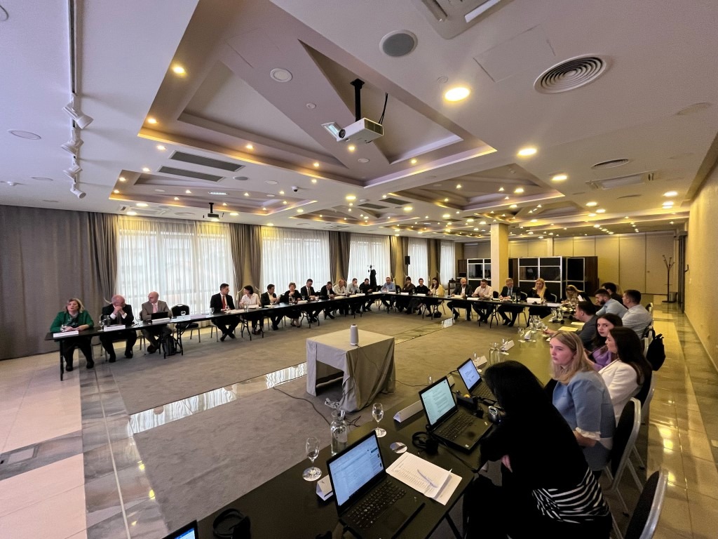
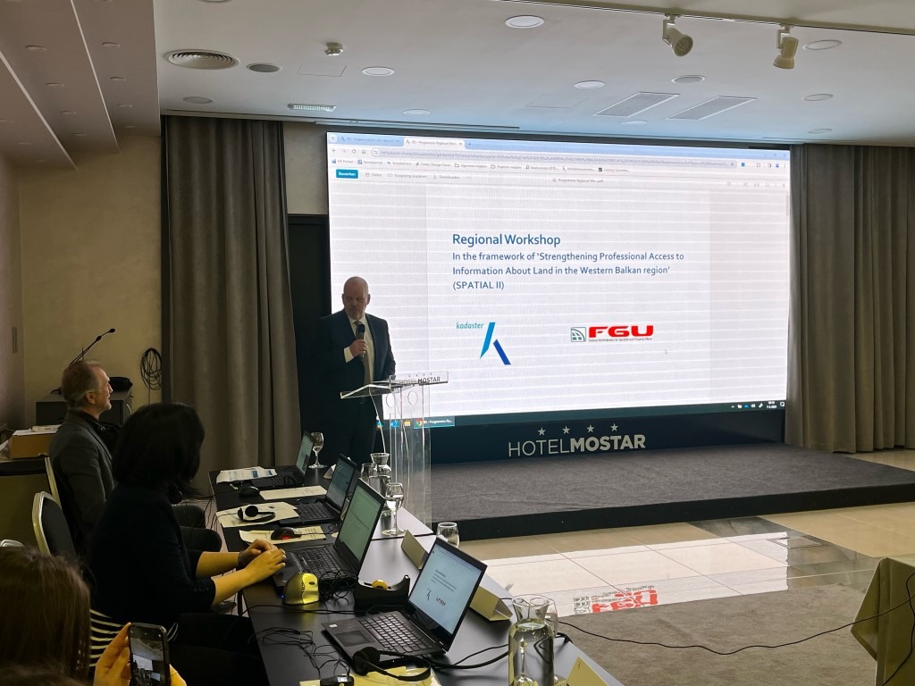
Within the organization of the Federal Administration for Geodetic and Real Property Affairs and the Agency for Land Administration and Cartography of the Netherlands (Kadaster) during the period from 6-8, March 2024, a regional workshop was held in Mostar as part of the SPATIAL II project with the aim of strengthening professional access to information about land in the Western Balkan region. Representatives of all cadastral and geodetic administrations/agencies of the Western Balkans participated in the workshop.
The theme of this year’s workshop is “Data acquisition and data sharing strategies” and included presentations on the potential of remote sensing and aerial imagery for various applications such as mapping and object detection for building data collection. Various techniques (Artificial Intelligence, cloud points, 3D visualizations) are exemplified for different applications. Strategies for sharing geodata, e.g. standards, cloud-based solutions, cyber security, services and similar were also discussed.
The purpose of the workshop is to share the experiences between the agencies, since many of them face the same or similar challenges when creating spatial data, and precisely these challenges and their solutions are key elements for successful spatial data management.
The official website of the Spatial Data Infrastructure of the Federation of Bosnia and Herzegovina is intended for all readers who want to know more about spatial data and the Spatial Data Infrastructure (SPI). Given the fact that 80% of information is related to some spatial component, spatial data and its distribution are becoming of general interest. The increasing demands of users, as well as the increasing amount of spatial data due to the modern technologies of their collection, have encouraged the construction of complete systems for spatial data management, better known as spatial data infrastructures or geoinformation infrastructures. Spatial data is all around us, even though we often don’t notice it, they help us carry out our daily tasks and jobs, accompany us in our social activities and increase the value of other information that surrounds us. Due to its fundamental value, spatial data is needed by almost all economic branches and scientific disciplines, and spatial data, their management, their exchange and use form one of the foundations of the development of society. Without infrastructure we exist as separate individuals, while with infrastructure we exist as a community. Therefore, the infrastructure of spatial data allows us to create a community of producers and users of spatial data. Precisely for this reason, we want users to acquire basic knowledge about the value of spatial data and the infrastructure of spatial data. The basic purpose is to convey messages to IPP participants (IPP subjects and users) about the importance of spatial data for IPP development and significance.
Directo of the Federal Administration for Geodetic and Real Property Affairs and president of the SDI Council
In today’s society, infrastructure is the basis for the construction of any segment, whether it is traffic infrastructure, utility infrastructure, business infrastructure or spatial data infrastructure. Infrastructure by definition implies technical structures and systems that support society.
The goal of establishing the Spatial Data Infrastructure is to create the prerequisites to rationalize the collection of spatial data and to standardize isolated islands of data, at all levels, so that they can be networked and used with quality. Connecting different information that is spatially defined (georeferenced), enables users to carry out complex searches and analyzes and connect phenomena in space, the prerequisites for modern management of space and spatial resources are realized.
Establishing a single framework for spatial data would reduce duplication and redundancy of data and minimize the efforts that should be invested in data collection and management. Spatial data comes from different sources and producers, each with its own requirements and needs. In order for combining data from different sources and from different producers to be possible without additional efforts, it is necessary to use standards that will serve many users and facilitate the use of data. In this way, significant savings in resources, time and money are achieved, better connectivity, a culture of sharing and cooperation, and the transparency of administration and decision-making is strengthened.