INSPIRE Validator of the SDI FBiH

INSPIRE Validator of the SDI FBiH

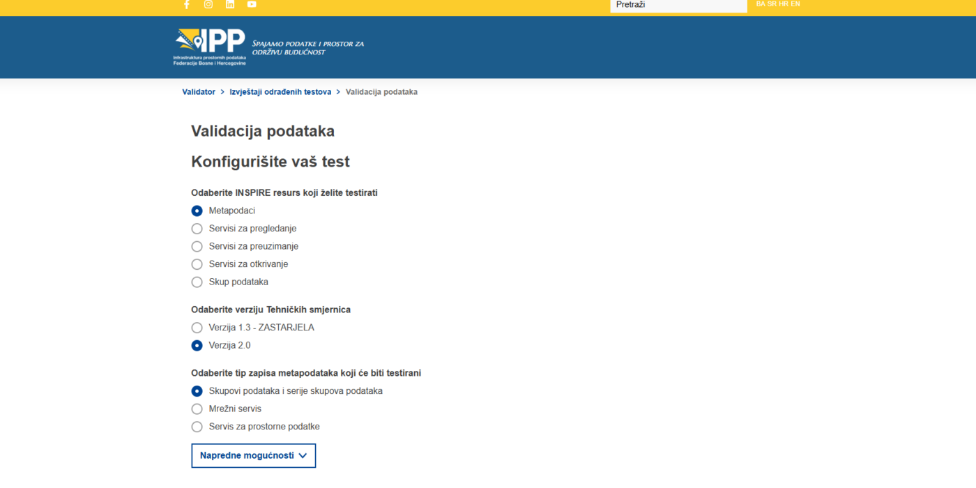
The INSPIRE Validator for the Spatial Data Infrastructure of the Federation of Bosnia and Herzegovina (SDI FBiH) has been launched on the SDI FBiH Geoportal. The INSPIRE Validator is a web-based application and service tailored to the needs of SDI FBiH, designed to validate spatial data, metadata, and services in accordance with the standards set by the INSPIRE Directive.

By deploying the INSPIRE Validator, the Federal Administration for Geodetic and Property Affairs enhances the availability of additional software tools for ensuring the quality, compliance, and interoperability of spatial data collected, processed, and shared within the Federation of Bosnia and Herzegovina. The availability of this tool will enable automated verification of spatial data, metadata, and services against INSPIRE Directive standards, national regulations, and best practices based on international standards.

The Validator simplifies and accelerates the validation process for spatial data, reducing the need for manual checks and ensuring consistency in the application of standards. Additionally, it will assist in identifying and correcting data errors, thereby improving data quality and reliability. Furthermore, the availability of the Validator will contribute to greater transparency and openness of data, facilitating its sharing and use by various Stakeholders.

The INSPIRE Validator will serve as a valuable tool for the Institutional Framework of SDI FBiH, SDI FBiH Stakeholders, and end users of spatial data.

Access to the INSPIRE Validator is available via the link below.
The Parliament of the Federation of BiH Adopts the Spatial Data Infrastructure Strategy of FBiH for the Period 2023 – 2027

The Parliament of the Federation of BiH Adopts the Spatial Data Infrastructure Strategy of FBiH for the Period 2023 – 2027

After the Government of the Federation of Bosnia and Herzegovina adopted the Spatial Data Infrastructure Strategy of the Federation of BiH (SDI FBiH) for the period 2023 – 2027 at a session held on October 4, 2023, both chambers of the Parliament of the Federation of BiH passed a decision formally confirming and adopting this strategic document.

The SDI FBiH Strategy 2023 – 2027 is a key multi-sectoral document that contributes to improving the availability, interoperability, and quality of spatial data. Its primary objectives include defining priority activities and projects that will enable more efficient use of spatial data in public administration, the private sector, and the academic community, facilitate digital transformation, and ensure compliance with EU directive requirements.

The process of drafting the Strategy began on July 14, 2022, with the Decision of the Government of FBiH No. V:1077/2022. The leading institutions responsible for its development are the Federal Administration for Geodetic and Real Property Affairs and the SDI FBiH Council, in accordance with the Law on the Spatial Data Infrastructure of FBiH. The drafting process involved public authorities responsible for spatial data, as well as relevant socio-economic partners.

The implementation of the Strategy will be carried out through three-year and annual work plans, the Framework Budget Document, and the FBiH budget, as well as through the Public Investment Program. Its realization will enable better management of spatial data, increased accessibility, and more efficient use in decision-making, economic development, and environmental protection.

Upon entering into force, the Spatial Data Infrastructure Strategy of the Federation of BiH 2023 – 2027 becomes the key framework for the coordinated development of spatial data in the Federation of BiH, thereby contributing to strengthening institutional capacities, more efficient resource management, and enhancing regional and international cooperation in the field of geoinformatics.

The strategy document can be downloaded from the official website of the Spatial Data Infrastructure of FBiH – www.ippfbih.gov.ba.

Invitation to SDI stakeholders of the Federation of BH to participate in the Public Consultation as Part of the GreenData4All Initiative

Invitation to SDI stakeholders of the Federation of BH to participate in the Public Consultation as Part of the GreenData4All Initiative

The European Commission invites you to participate in the public consultation as part of the GreenData4All initiative from February 5 to April 30, 2025. This initiative is essential for supporting Europe’s green and digital transformation by making environmental data more accessible, available, and reusable. The Commission aims to gather stakeholders’ opinions on the issues identified in the evaluation of the INSPIRE Directive, the challenges of the rapidly evolving European data landscape, and possible approaches to addressing these issues.

The consultation seeks feedback from all interested parties, including citizens, environmental and spatial data experts, organizations from various sectors (environment, geospatial data, marine, agriculture, utilities, smart cities, mobility, energy), businesses, non-governmental organizations, academia, and international partners.

The consultation is open until April 30, 2025, and contributions can be submitted in all 24 official EU languages. You can contribute to this consultation by completing the online questionnaire: Link to the questionnaire. The questionnaires are available in some or all official EU languages. You can submit your responses in any official EU language. For transparency purposes, organizations and companies participating in the public consultation are required to register in the EU Transparency Register.

By participating, you will help ensure that the updated rules on environmental data meet the needs of all users, from policymakers and businesses to the general public. By joining this initiative, you will contribute to shaping a more sustainable and digitally advanced Europe.

About the GreenData4All Initiative

The GreenData4All initiative addresses the growing need for better sharing of environmental data. This is essential for developing effective policies that protect our environment and support a strong data economy. By making environmental data more accessible, GreenData4All aims to support evidence-based decision making and empower European businesses and startups to create more innovative services.

Initiative objectives:

  • Enhance Data Sharing: Contribute to a coherent ecosystem for environmental data sharing, making the existing legal framework for sharing geospatial data (INSPIRE Directive) future-proof and aligned with other European data sharing legislation (Open Data Directive, Data Governance Act).
  • Support Environmental Policy: Ensure that environmental data is easily accessible and meets the needs of end-users, facilitating better policy implementation and decision-making.
  • Promote Digital Transformation: Contribute to making environmental data more accessible and reusable for all users, thereby boosting competitiveness and innovation across the EU.

Forty-fifth session of the SDI Council of FBiH held

Forty-fifth session of the SDI Council of FBiH held

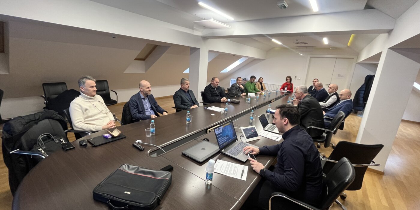
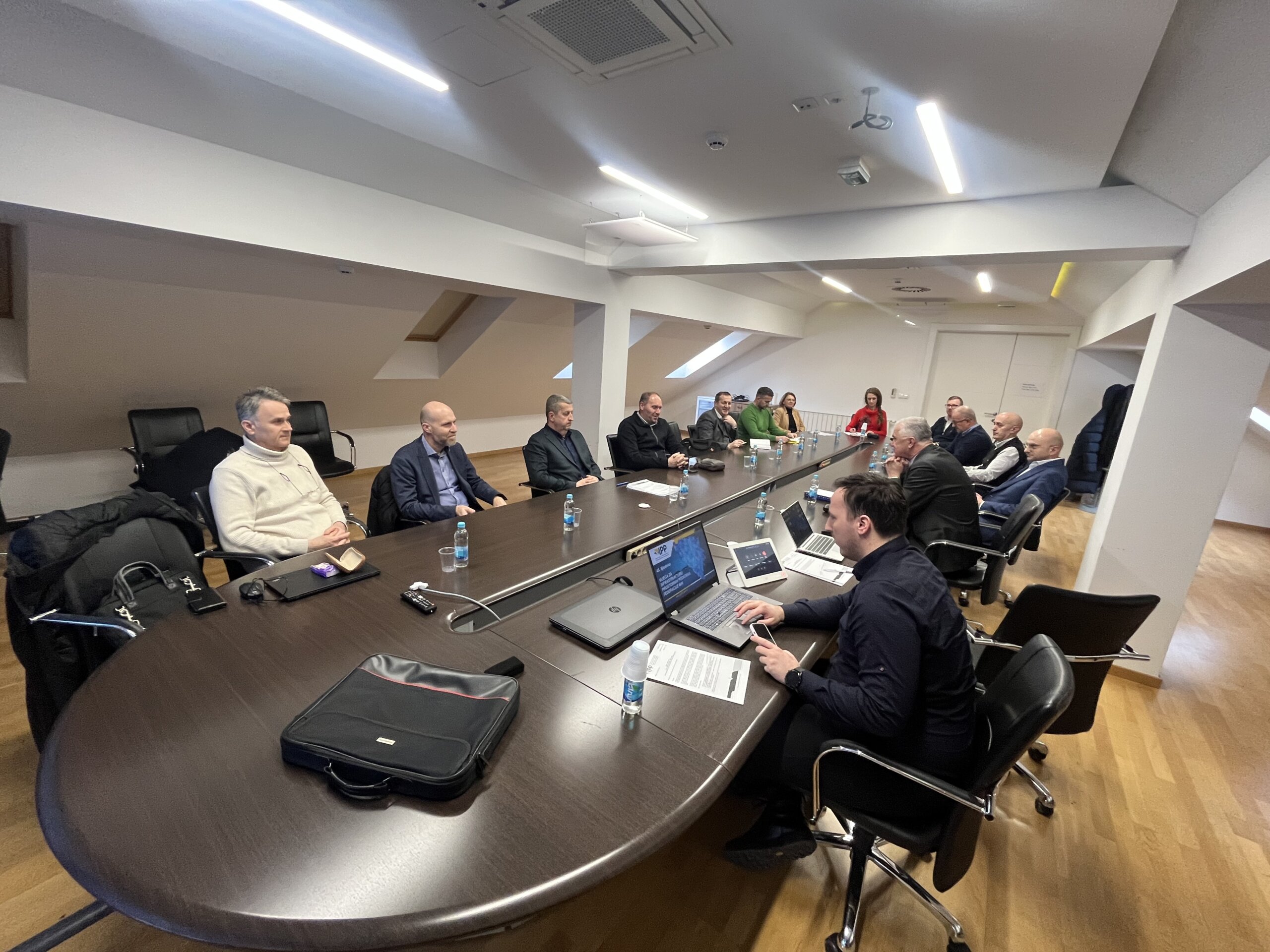
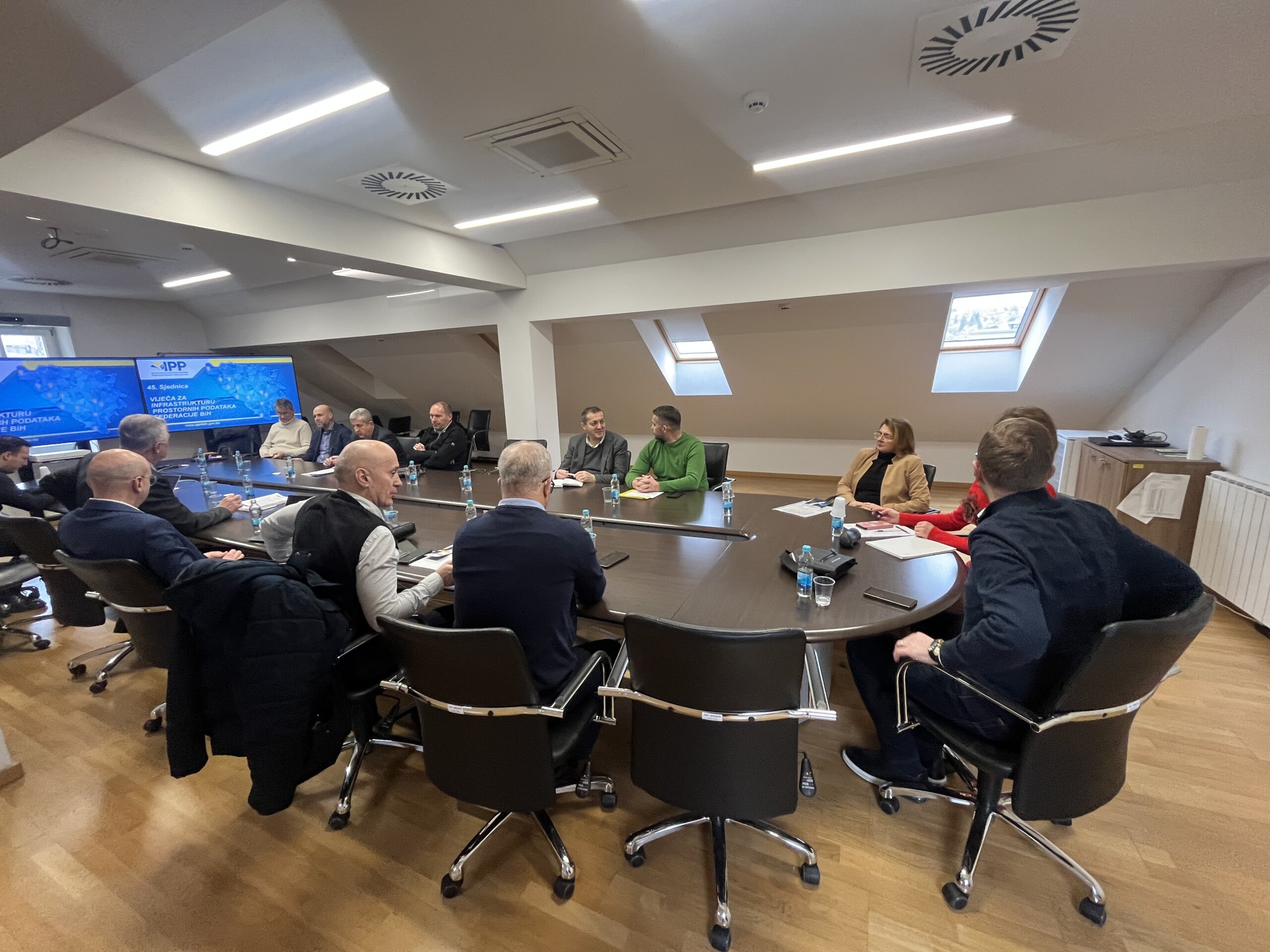
The forty-fifth session of the Spatial Data Infrastructure of the Federation of BiH Council (SDI FBiH Council) was held in the premises of the Federal Administration for Geodetic and Real Property Affairs on February 18, 2025.

At the session, the Council has discussed:

  1. Determining the Agenda of the 45th session of the SDI FBiH Council;
  2. Approval of the Minutes from the previous 44th session of the SDI FBiH Council;
  3. Information on the adoption of the Report on the establishment, maintenance and development of the SDI FBiH for 2024;
  4. Information and proposal of the Work Plan for the establishment, maintenance and development of the SDI FBiH for the Year 2025;
  5. Adoption of the Communication Plan;
  6. Adoption of the Framework Study for Spatial Data Licensing;
  7. Information on the approval of the implementation of the GeoConnect project;
  8. Other.

The Federal Administration for Geodetic and Real Property Affairs, as the Coordinating body of the SDI FBiH, prepared and submitted to the members of the Council the Work Plan for the establishment, maintenance and development of the SDI FBiH for the Year 2025 for consideration and final adoption. The proposed Work Plan, which includes the Education Plan for 2025, was unanimously adopted by the SDI Council. At this session, the Council adopted the Communication Plan and the Framework Study for Spatial Data Licensing, which will be the basis for further action in SDI.

In accordance with the SDI Strategy for the period 2023-2027 and the Action plan for 2025, activities will continue in terms of increasing the number of stakeholders and available sources in order to raise the level of availability and interoperability of spatial data. Continuous work will be carried out on the implementation of the Law on SDI and other regulations, as well as the creation of a formal framework that will be the subject of future activities in the field of the SDI FBiH. Also, during the next period, the focus will be on improving existing technological frameworks, enhancing the development of network services based on existing spatial data sets, and promoting the importance of SDI through the implementation of a communication plan. During 2025, it was planned at least 4 sessions to accompany these activities.

Call for Participation in FOSS4G Europe 2025 – Mostar

Call for Participation in FOSS4G Europe 2025 – Mostar

The Federal Administration for Geodetic and Real Property Affairs (FGA), as the conference sponsor, invites the stakeholders of the Spatial Data Infrastructure of the Federation of BiH (SDI FBiH) to participate in FOSS4G Europe 2025, the leading European conference on open geospatial technologies, which will be held in Mostar from July 1 to July 5, 2025. 

This event represents a unique opportunity for institutions and organizations involved in the development of SDI FBiH to showcase their projects, exchange experiences, and contribute to the advancement of geospatial data utilization at both the national and international levels. 

We invite you to submit presentations, lectures, and papers and to showcase initiatives that contribute to the development of spatial technologies, open data, and spatial analysis, with a particular focus on their application within SDI FBiH. 

The deadline for presentation submissions is the end of this week, so we encourage you not to miss this opportunity to promote your activities and achievements! 

🔗 More information on the call for presentations:
https://2025.europe.foss4g.org/call-for-proposals/general-program/

🔗 Presentation submission:
https://talks.osgeo.org/foss4g-europe-2025/cfp

Participation in the conference will enable you to network with international experts, exchange knowledge, and explore innovative solutions in geospatial data applications. 

We look forward to your participation and contribution to strengthening SDI FBiH through FOSS4G Europe 2025!

GeoConnect Grant Project Approved for the Federation of Bosnia and Herzegovina

GeoConnect Grant Project Approved for the Federation of Bosnia and Herzegovina

The Federal Administration for Geodetic and Real Property Affairs is pleased to announce the approval of the GeoConnect project: Connecting Geoinformatics Expertise for Responsible and Transparent Governance.

This significant project, funded by the Government of the Kingdom of the Netherlands through the Matra Government to Government (Matra G2G) program, aims to strengthen the Spatial Data Infrastructure of the Federation of Bosnia and Herzegovina (SDI FBiH – http://www.ippfbih.gov.ba) in line with European and international standards. The total project budget is €1.1 million, with an implementation period of four years (2025–2029).

GeoConnect is the result of a long-standing collaboration between the Federal Administration for Geodetic and Real Property Affairs and leading European institutions in the field of geospatial data. The project implementation will be led by Kadaster International (the Netherlands’ Cadastre, Land Registry and Mapping Agency) and the Faculty of Geo-Information Science and Earth Observation (ITC) at the University of Twente, in cooperation with the Faculty of Civil Engineering at the University of Sarajevo and University of Mostar, as well as the Belgian Catholic University KU Leuven.

Project objectives:

  • Enhancing the capacity of the coordinating body and SDI entities in the Federation of Bosnia and Herzegovina for spatial data management through specialized training and mentorship programs.
  • Developing standardized and interoperable geospatial data, aligned with the European Union’s INSPIRE Directive.
  • Raising awareness about the importance of spatial data in public resource management, sustainable development, and data-driven decision-making.

The four-year project will include a series of technical workshops, study visits, educational programs, and public awareness campaigns.

As the primary beneficiary and project coordinator within the Federation of Bosnia and Herzegovina, the Federal Administration for Geodetic and Real Property Affairs emphasizes the importance of this initiative in strengthening responsible governance and preparing Bosnia and Herzegovina for future EU membership.

We extend our gratitude to all partners for their trust and look forward to the successful joint implementation of this strategic project.

Federal Administration for Geodetic and Real Property Affairs

Working hours: 08:00 - 16:00
Contact phone: 033/712-616
E-mail: ipp.fbih@fgu.com.ba

Hamdije Kreševljaković br.96

Sarajevo 71000

©FGU 2024, ALL RIGHTS RESERVED.