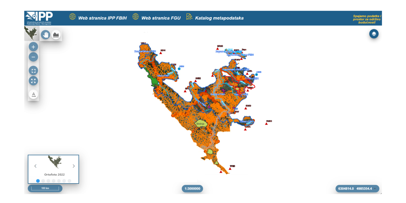
Overview of access to data and services provided by SDI FBiH
Overview of access to data and services provided by SDI FBiH
The Federal Administration for Geodetic and Real Property Affairs has been actively working with the SDI FBiH stakeholders on harmonizing spatial data according to the technical specifications of the INSPIRE Directive. Through the ETL procedures project, which began in 2023 and concluded at the beginning of 2024, harmonization was achieved for 12 sources of spatial data under the jurisdiction of 5 SDI FBiH stakeholders.
Harmonization of spatial data involves several phases. First, there is the phase of analyzing the initial data state, data models, and formats, with the main goal being to obtain information about the current data status and provide recommendations for the next phase. The next phase is data modeling, while the final phase involves defining, creating, and executing ETL procedures. After completing all three phases, the final delivery includes an INSPIRE-compliant GML for each data source, an ETL scheme for updating purposes, and accompanying documentation (reports, analyses, models, etc.). Following this, web services are created to facilitate data viewing, and metadata is generated for the treated spatial data sources if not previously created.
The following institutions participated in the latest project with their respective spatial data sources:
- Ministry of Spatial Planning and Environmental Protection of Tuzla Canton
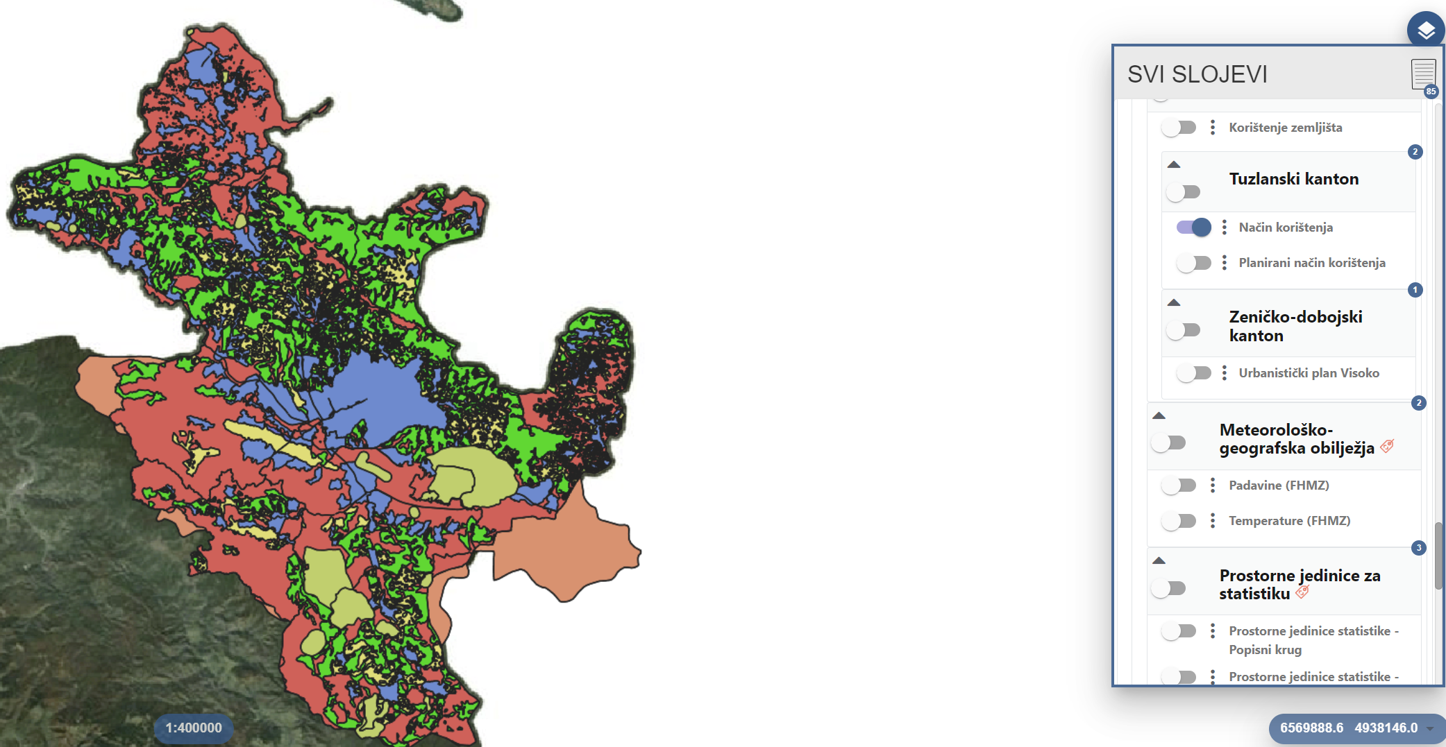
- Source: Spatial Planning Documentation (INSPIRE theme: Land Use)
- Land use
- Planned land use
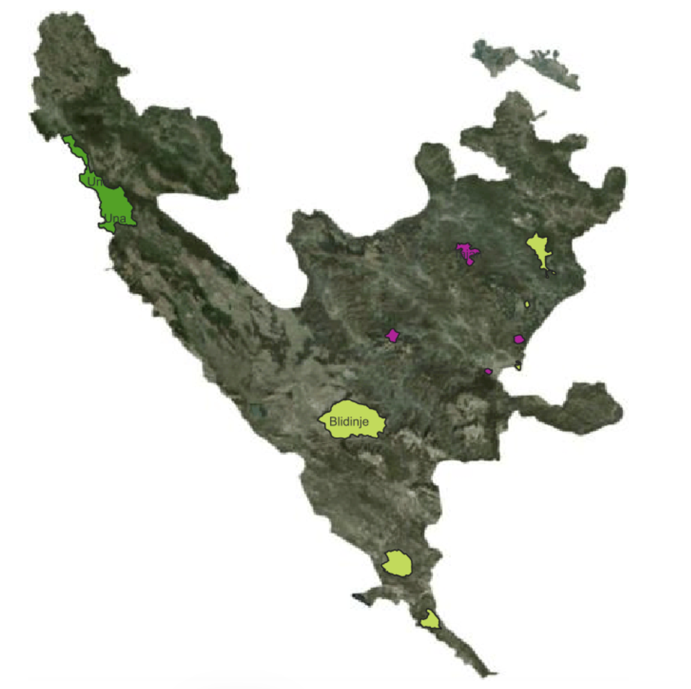
- Source: Spatial Planning Documentation (INSPIRE theme: Protected Sites)
- Modrac
- Konjuh
- Source: Spatial Planning Documentation (INSPIRE theme: Land Use)
- Institute for Urbanism and Spatial Planning of Zenica-Doboj Canton
- Source: Spatial Planning Documentation (INSPIRE theme: Land Use)
- Planned land use – Visoko
- Source: Spatial Planning Documentation (INSPIRE theme: Land Use)
- Federal Institute for Agropedology
- Source: Basic Pedological Map of FBiH (INSPIRE theme: Soil)
- Planning Institute of Sarajevo Canton
- Source: Spatial Planning Documentation (INSPIRE theme: Land Use)
- Hadžići
- Bijambare
- Spatial Plan of Sarajevo Canton
- Urban Plan of Sarajevo Canton
- Skakavac
- Source: Spatial Planning Documentation (INSPIRE theme: Land Use)
- Federal Institute for Geology
- Source: Geological Mapping Documentation (INSPIRE theme: Geology)
- Lithostratigraphic units in FBiH
- Source: Geological Mapping Documentation (INSPIRE theme: Geology)
The Federal Administration has also developed ETL procedure projects for data sources under its jurisdiction. To date, this has been done for all data from the following themes:
- Administrative Units
- Geographical Names
- Coordinate Reference Systems
- Gravimetric Reference Framework
- Spatial Reference Framework
- Height Reference Framework
- Geographic Grid Systems
- Division into cadastral plan sheets
- Division into topographic map sheets
- Addresses
- Orthophoto Images
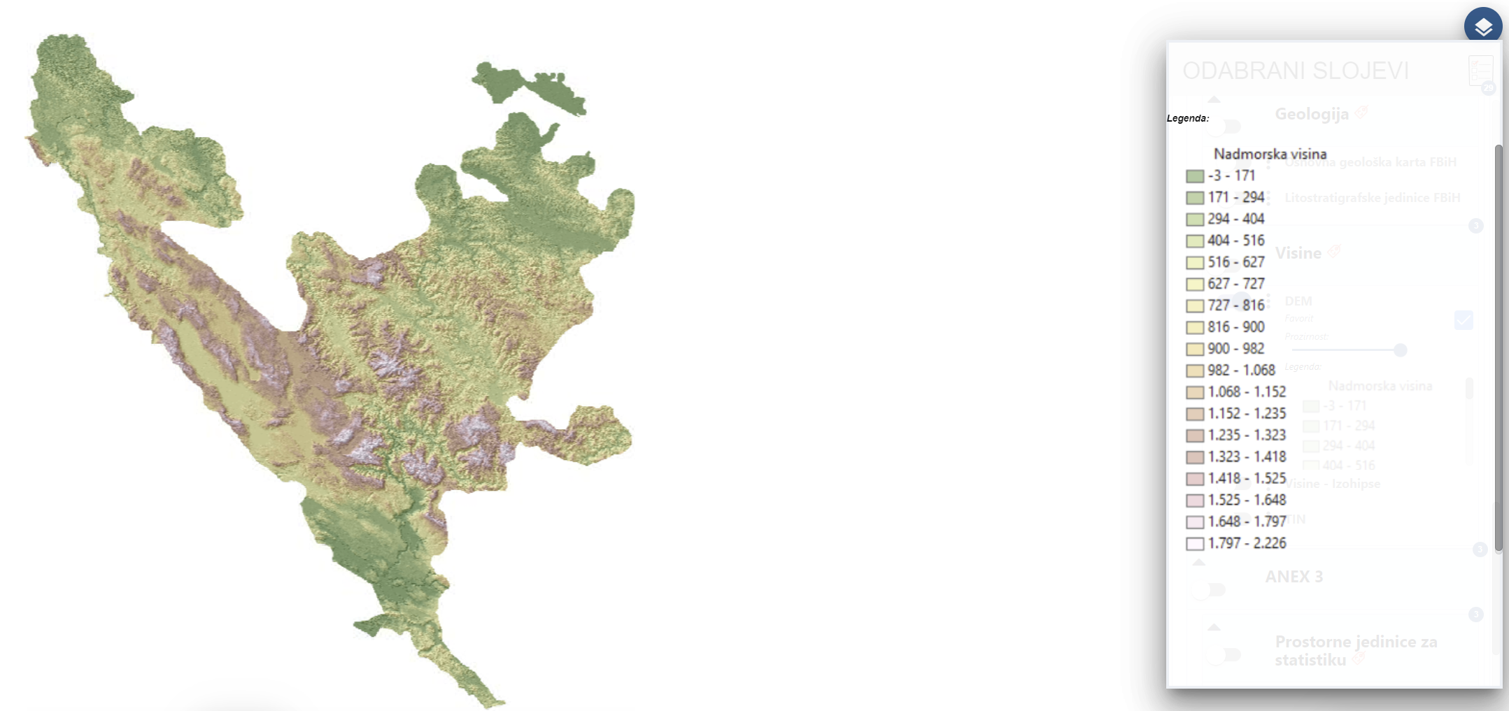
- Elevations
- Terrain Models
- Contour Lines
The Federal Administration will review, enhance, and update all ETL procedures in the upcoming period and create additional ETL procedures for the remaining data. The main goal is a repository of INSPIRE-compliant GML records and accompanying services for all data under the jurisdiction of FGU.
Additionally, as a result of previously completed projects, ETL procedures have been developed for harmonizing the following data sets, which are available for viewing:
- Federal Institute for Statistics
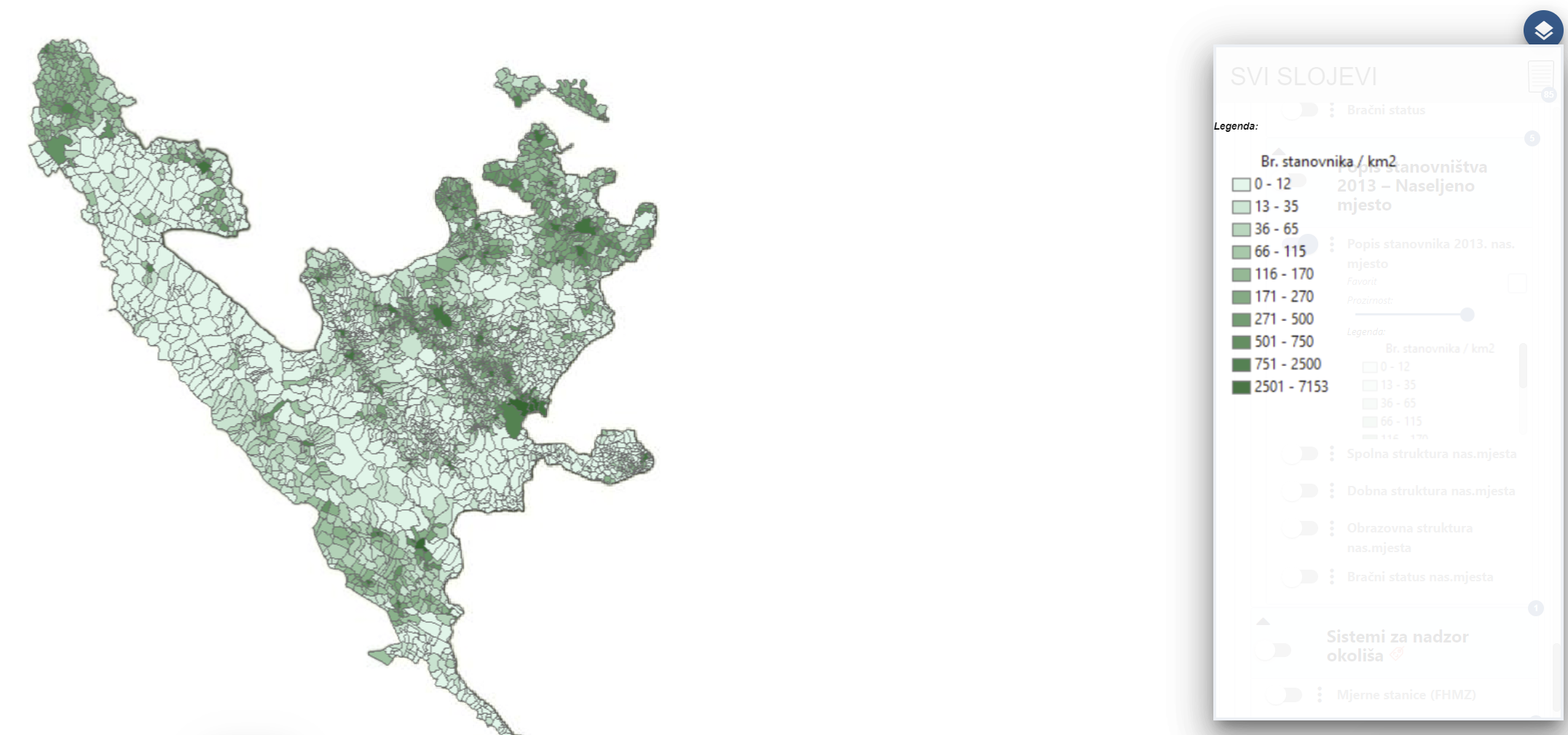
- Spatial units for statistics
- Population distribution and demographics
- Federal Hydrometeorological Institute
- Meteorological-geographical features
- Average temperatures
- Average precipitation
- Environmental monitoring systems
- Observation stations
- Meteorological-geographical features
- Sava River Basin Agency
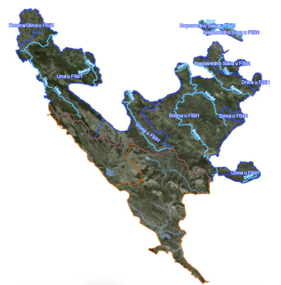
- Hydrography (Watercourses, Sub-basins)
- Adriatic Sea Basin Agency
- Hydrography (Watercourses, Sub-basins, Natural Lakes, Reservoirs)
- Environmental Protection Fund of FBiH
- Protected areas according to the Nature Protection Law
- Federal Ministry of Spatial Planning
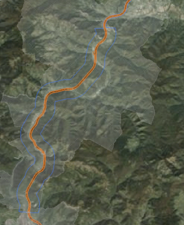
- Protected areas (Highway Vc)
- Land use
- Federal Institute for Geology
- Basic Geological Map of FBiH
All available data is described with metadata, and over 300 metadata records have been entered for spatial data under the jurisdiction of all mentioned institutions. The entry of additional metadata into the SDI FBiH Metadata Catalog is ongoing.
Current statistics on the Geoportal Viewer are as follows:
|
Number of data layers |
78 |
|
Number of covered INSPIRE themes |
16 |
|
Number of stakeholders sharing data |
12 |
You can access the Metadata Catalog via the URL: https://metapodaci.ippfbih.gov.ba.
For example, on the viewer, you can review data under the jurisdiction of the Federal Institute for Geology:
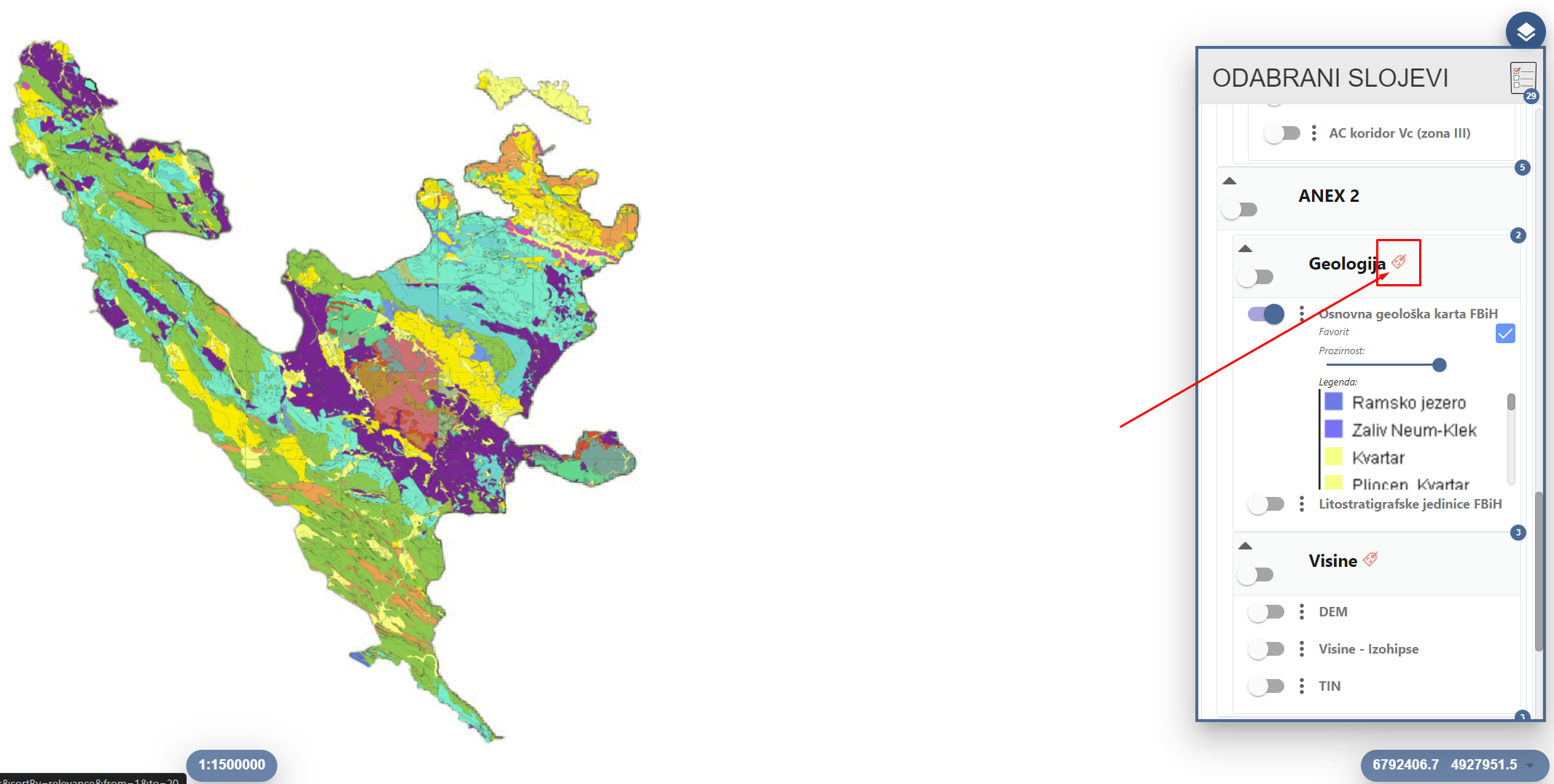
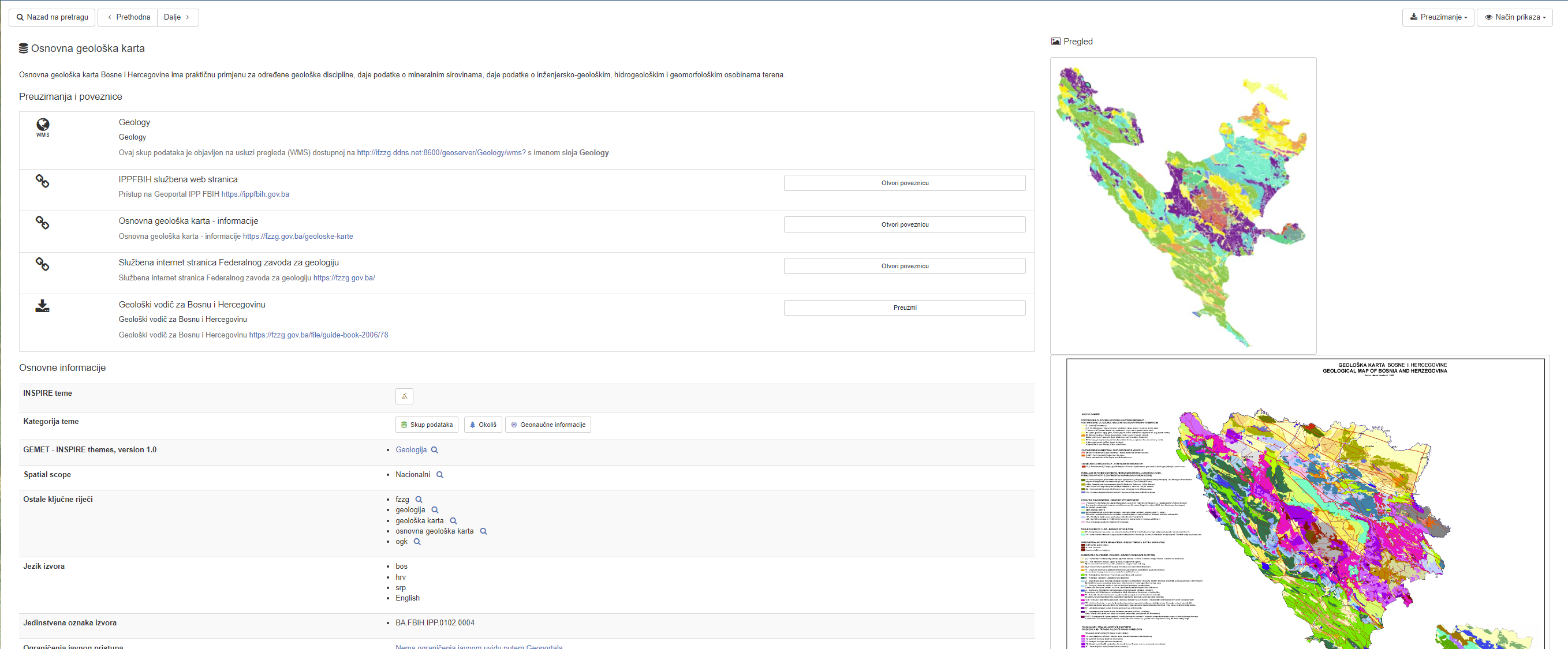
Additionally, you can find information about how to access the data, the responsible institutions, access conditions, data quality, temporal reference, and more (see the image below). All of this is available by clicking on the Metadata option (arrow in the image above).
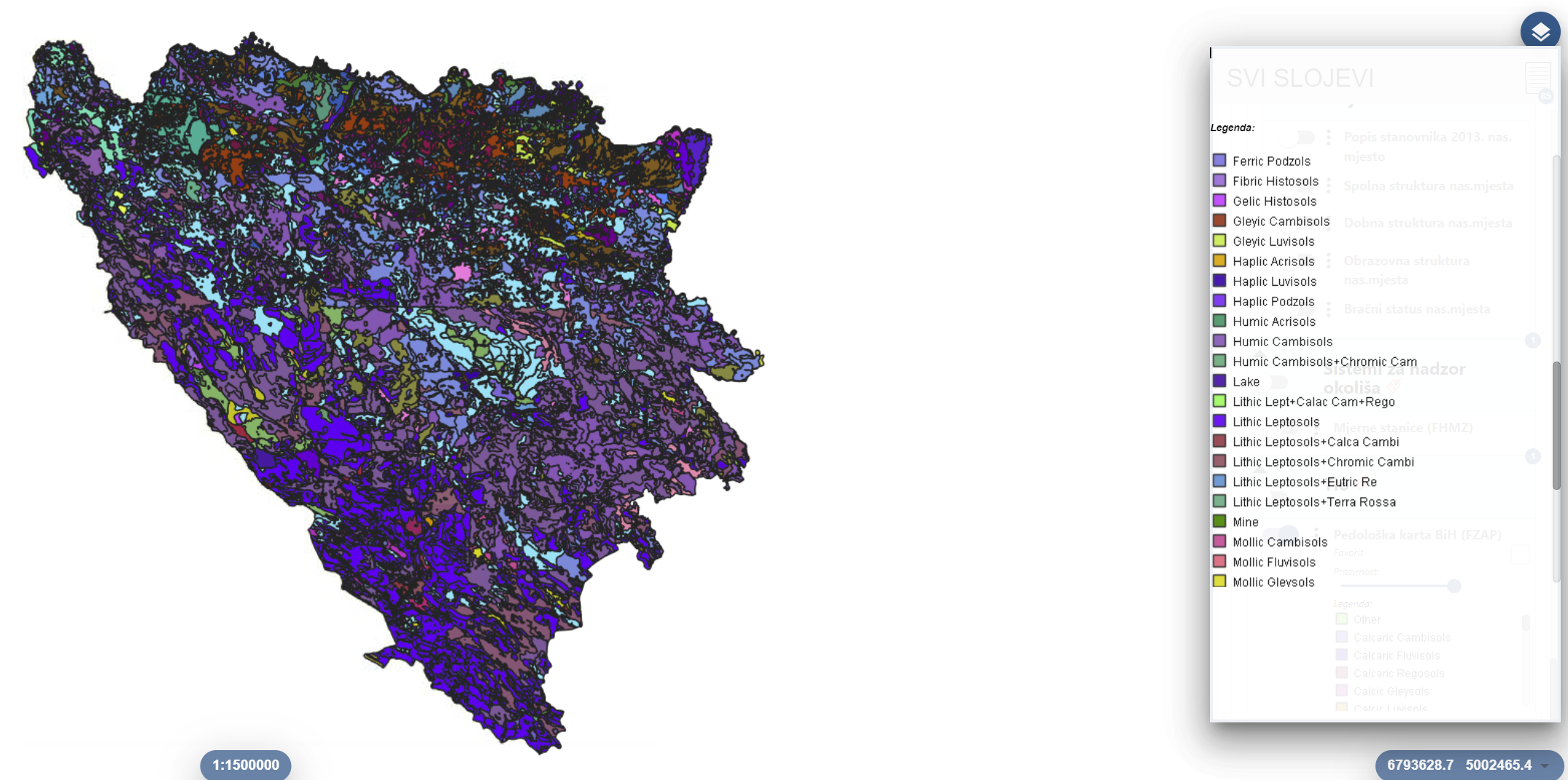
Below are a few more examples of spatial data under the jurisdiction of various institutions, which you can view on the SDI Geoportal, and get additional information by consulting the Metadata Catalog.

The Federal Administration is actively working on maintaining the Viewer and the Metadata Catalog, and it collaborates with all stakeholders to ensure that all spatial data in the Federation of BiH is harmonized according to INSPIRE technical guidelines, made interoperable, and accessible via internet services. Over time, all spatial data will be available on the SDI Geoportal for view service, described with metadata for search and additional information purposes, and the Federal Administration will also work on providing transformation and download services.
For user inquiries or if you encounter any difficulties with accessing and viewing the data, please contact: ipp.fbih@fgu.com.ba.

